Mark Booth
Senior HTF Member
- Joined
- Aug 25, 1999
- Messages
- 3,580
Yesterday was a really interesting day! You may have seen mention on the National news regarding the atmospheric river that hit SoCal yesterday? Well, it hit San Diego County especially hard. And, within the County, there was a 10 or so mile tall swath that got hit harder than the rest of the county, from the coast all the way to the mountains. Our home lies within that swath. This NWS satellite image sums it up.

That was at 10:04 am on Tuesday. I received a Flash Flood Warning on my iPhone about 10:15 am. The rather long area of red moved on shore and moved directly over our area. By 10:20 am the rain was torrential. I've lived in San Diego almost all of my life and lived in our house for 35 years, I've never seen it rain like it did on Tuesday.
Our house is at the bottom of a long hill in our association. About 10:30 am, I opened our big garage door to evaluate conditions. There was a river of water flowing down our street, overwhelming the gutters at the outside curve (thank goodness our house is on the inside of the curve).
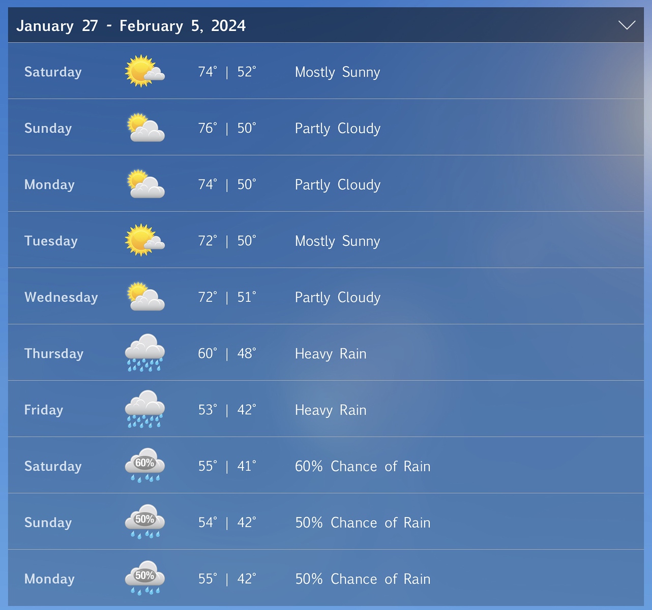
We have a personal weather station. Several months ago I carefully calibrated the rain gauge. I also compared its numbers to the numbers from the closest official NWS gauge and, trust me, our station's rain gauge is accurate. It recorded 4.21 inches of rain on Tuesday from 6:30 am until about 5:30 pm. Just 11 hours. However, the majority of it fell between 10:15 am and 11:00 am. We got about 2.5 inches in 45 minutes! INCREDIBLE!
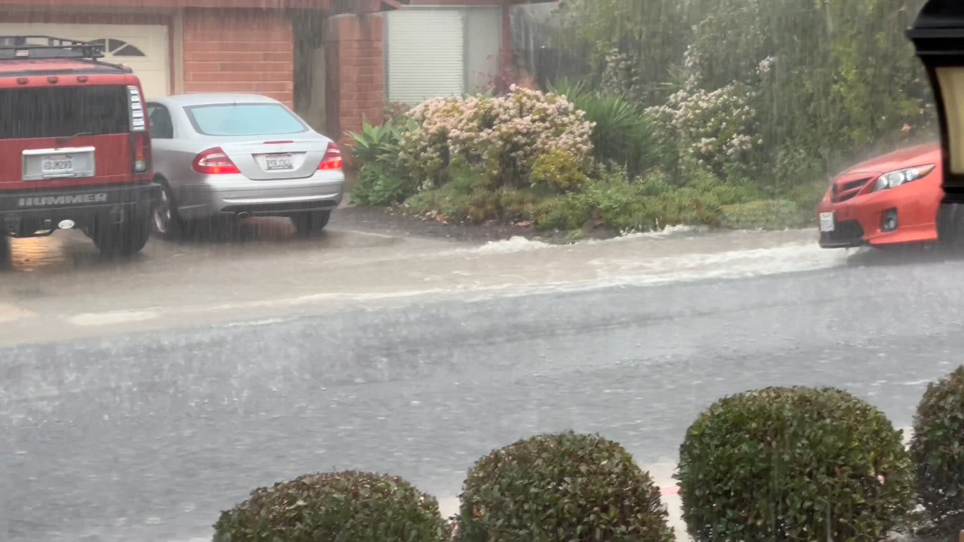
What does that look like on a SoCal street in the foothills of San Diego County? Like this:
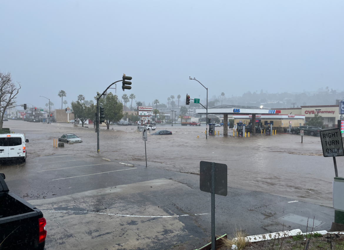
No damage or flooding in our immediate area. But low-lying areas nearby were affected. This is the gas station we frequent, about 2 miles away:
To the west of us, some low-lying areas were hit much harder. This is a 4-foot deep storm drain channel that normally has barely more than a trickle running through it.
The water overflowed the banks of the channel and caused this.
Overnight, we received another .93 inches, putting the less-than-24-hour total (6:30 am - 3:30 am) at 5.14 inches. That is HALF of the normal YEARLY rainfall for our area!! All in less than 24 hours!
Like I said, it was an interesting day!
Mark

That was at 10:04 am on Tuesday. I received a Flash Flood Warning on my iPhone about 10:15 am. The rather long area of red moved on shore and moved directly over our area. By 10:20 am the rain was torrential. I've lived in San Diego almost all of my life and lived in our house for 35 years, I've never seen it rain like it did on Tuesday.
Our house is at the bottom of a long hill in our association. About 10:30 am, I opened our big garage door to evaluate conditions. There was a river of water flowing down our street, overwhelming the gutters at the outside curve (thank goodness our house is on the inside of the curve).
We have a personal weather station. Several months ago I carefully calibrated the rain gauge. I also compared its numbers to the numbers from the closest official NWS gauge and, trust me, our station's rain gauge is accurate. It recorded 4.21 inches of rain on Tuesday from 6:30 am until about 5:30 pm. Just 11 hours. However, the majority of it fell between 10:15 am and 11:00 am. We got about 2.5 inches in 45 minutes! INCREDIBLE!
What does that look like on a SoCal street in the foothills of San Diego County? Like this:
No damage or flooding in our immediate area. But low-lying areas nearby were affected. This is the gas station we frequent, about 2 miles away:
To the west of us, some low-lying areas were hit much harder. This is a 4-foot deep storm drain channel that normally has barely more than a trickle running through it.
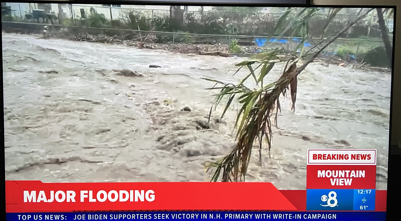
The water overflowed the banks of the channel and caused this.

Overnight, we received another .93 inches, putting the less-than-24-hour total (6:30 am - 3:30 am) at 5.14 inches. That is HALF of the normal YEARLY rainfall for our area!! All in less than 24 hours!
Like I said, it was an interesting day!
Mark